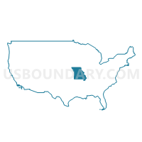
St. Francois, Washington, Perry & Ste. Genevieve Counties PUMA, Missouri
About
Outline

Summary
| Unique Area Identifier | 193313 |
| Name | St. Francois, Washington, Perry & Ste. Genevieve Counties PUMA |
| State | Missouri |
| Area (square miles) | 2,208.10 |
| Land Area (square miles) | 2,185.31 |
| Water Area (square miles) | 22.79 |
| % of Land Area | 98.97 |
| % of Water Area | 1.03 |
| Latitude of the Internal Point | 37.86193620 |
| Longtitude of the Internal Point | -90.40879980 |
Maps
Graphs
Select a template below for downloading or customizing gragh for St. Francois, Washington, Perry & Ste. Genevieve Counties PUMA, Missouri


Neighbors
Neighoring Public Use Microdata Area (by Name) Neighboring Public Use Microdata Area on the Map
- Butler, Ripley, Wayne, Madison, Iron, Reynolds & Carter Counties PUMA, MO
- Cape Girardeau, Scott & Bollinger Counties PUMA, MO
- Franklin County PUMA, MO
- Jackson, Williamson, Franklin & Perry Counties PUMA, IL
- Jefferson County (South) PUMA, MO
- Monroe, Randolph, Washington, Jefferson & Marion Counties PUMA, IL
- Phelps, Crawford, Dent, Gasconade & Maries Counties PUMA, MO
- South & Southeast Illinois PUMA, IL
Top 10 Neighboring County (by Population) Neighboring County on the Map
- Jefferson County, MO (218,733)
- Franklin County, MO (101,492)
- Cape Girardeau County, MO (75,674)
- St. Francois County, MO (65,359)
- Jackson County, IL (60,218)
- Randolph County, IL (33,476)
- Monroe County, IL (32,957)
- Washington County, MO (25,195)
- Crawford County, MO (24,696)
- Perry County, MO (18,971)
Top 10 Neighboring County Subdivision (by Population) Neighboring County Subdivision on the Map
- St. Francois township, St. Francois County, MO (29,371)
- Valle township, Jefferson County, MO (15,153)
- Perry township, St. Francois County, MO (12,617)
- Plattin township, Jefferson County, MO (11,576)
- Central township, Perry County, MO (10,875)
- Breton township, Washington County, MO (10,326)
- Randolph township, St. Francois County, MO (10,161)
- Meramec township, Franklin County, MO (9,382)
- Chester precinct, Randolph County, IL (9,314)
- Ste. Genevieve township, Ste. Genevieve County, MO (8,991)
Top 10 Neighboring Place (by Population) Neighboring Place on the Map
- Farmington city, MO (16,240)
- Park Hills city, MO (8,759)
- Perryville city, MO (8,225)
- Bonne Terre city, MO (6,864)
- Desloge city, MO (5,054)
- Ste. Genevieve city, MO (4,410)
- Potosi city, MO (2,660)
- Terre du Lac CDP, MO (2,320)
- Bismarck city, MO (1,546)
- Leadwood city, MO (1,282)
Top 10 Neighboring Elementary School District (by Population) Neighboring Elementary School District on the Map
- Jefferson County R-VII School District, MO (5,999)
- Lonedell R-XIV School District, MO (3,476)
- Sunrise R-IX School District, MO (3,289)
- Richwoods R-VII School District, MO (1,651)
- Belleview R-III School District, MO (1,426)
- Altenburg 48 School District, MO (1,046)
- Prairie du Rocher Community Consolidated School District 134, IL (899)
Top 10 Neighboring Secondary School District (by Population) Neighboring Secondary School District on the Map
Top 10 Neighboring Unified School District (by Population) Neighboring Unified School District on the Map
- Jackson R-II School District, MO (30,067)
- Farmington R-7 School District, MO (27,796)
- North St. Francis County R-I School District, MO (20,261)
- Perry County 32 School District, MO (17,763)
- De Soto School District, MO (17,199)
- Ste. Genevieve County R-II School District, MO (15,185)
- Potosi R-III School District, MO (13,408)
- St. Clair R-XIII School District, MO (12,448)
- Sullivan School District, MO (11,771)
- Central R-III School District, MO (11,625)
Top 10 Neighboring State Legislative District Lower Chamber (by Population) Neighboring State Legislative District Lower Chamber on the Map
- State House District 116, IL (110,789)
- State House District 115, IL (105,561)
- State House District 107, MO (40,428)
- State House District 103, MO (39,604)
- State House District 98, MO (38,996)
- State House District 106, MO (38,873)
- State House District 157, MO (37,900)
- State House District 110, MO (37,588)
- State House District 150, MO (36,107)
- State House District 104, MO (35,833)
Top 10 Neighboring State Legislative District Upper Chamber (by Population) Neighboring State Legislative District Upper Chamber on the Map
- State Senate District 58, IL (216,350)
- State Senate District 26, MO (189,096)
- State Senate District 16, MO (188,295)
- State Senate District 3, MO (174,508)
- State Senate District 27, MO (172,783)
Top 10 Neighboring 111th Congressional District (by Population) Neighboring 111th Congressional District on the Map
- Congressional District 9, MO (684,101)
- Congressional District 12, IL (666,459)
- Congressional District 8, MO (656,894)
- Congressional District 3, MO (625,251)
Top 10 Neighboring Census Tract (by Population) Neighboring Census Tract on the Map
- Census Tract 9507, St. Francois County, MO (8,057)
- Census Tract 9503, St. Francois County, MO (7,866)
- Census Tract 9511, St. Francois County, MO (7,781)
- Census Tract 9509.02, St. Francois County, MO (7,134)
- Census Tract 9504, St. Francois County, MO (6,866)
- Census Tract 9510, St. Francois County, MO (6,820)
- Census Tract 4601, Washington County, MO (6,525)
- Census Tract 9512, Randolph County, IL (6,422)
- Census Tract 9601, Ste. Genevieve County, MO (6,342)
- Census Tract 4501.02, Crawford County, MO (6,187)
Top 10 Neighboring 5-Digit ZIP Code Tabulation Area (by Population) Neighboring 5-Digit ZIP Code Tabulation Area on the Map
- 63028, MO (26,413)
- 63640, MO (26,335)
- 63755, MO (24,006)
- 63020, MO (20,714)
- 63775, MO (16,710)
- 63601, MO (16,656)
- 63628, MO (16,014)
- 63080, MO (13,987)
- 63645, MO (11,420)
- 63670, MO (11,295)


